70count locations
US-169 Corridor Counts
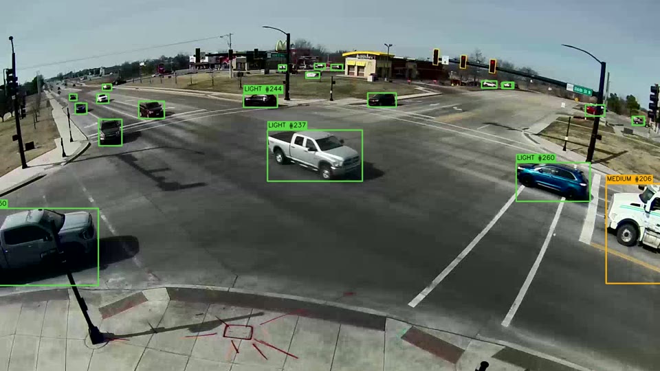
22 intersections + 48 multi-day count & classification.
Completed in one week


Oklahoma City · Dallas–Fort Worth · crews deploy nationwide
TDS Traffic collects turning movement, volume, classification, speed, pedestrian and bicycle counts, and video-based safety analytics, for public agencies and engineering firms, with independent QC and engineering-ready deliverables. Corridor and citywide programs are typically delivered in about one week.
(405) 762-3924 Oklahoma · (682) 246-6910 Texas · support@tdstraffic.com
Services
Vehicle movements by approach and class, with pedestrian and bicycle crossings, in configurable intervals for signal, capacity and traffic impact studies.
Directional roadway volumes over 24-hour, 48-hour or multi-day periods, including hourly and 15-minute data, daily totals and ADT summaries.
FHWA 13-class vehicle classification by direction and hour, or project-specific class groupings when required.
Speed distributions for residential streets, arterials and highways, including 85th-percentile speed, pace and speed bins.
Pedestrian and bicycle counts by crossing leg or screenline in 15-minute intervals, for multimodal and safety studies.
Multi-location programs can be delivered through an interactive web map or dashboard, with GIS-ready spatial data for agency or consultant workflows.
Intersection inventories, site assessments and pedestrian-facility documentation with geotagged photographs, delivered as condition diagrams, photo sets and GIS points.
Coordinated collection across multiple intersections and roadway segments, with centralized scheduling, consistent QC and consolidated reporting.
Video-based conflict analysis at intersections: near misses are measured by movement pair over 24 to 72 hours and reported with an annotated clip of every event.
Projects
70count locations
22 intersections + 48 multi-day count & classification.
Completed in one week
60intersections
With pedestrian & bicycle counts.
Completed in two weeks on an accelerated schedule
80vision-based count locations
Completed in about 2.5 weeks, within budget.
Count spreadsheet, 15-minute raw files, and State Plane GIS shapefile
Clients









Service area
The Oklahoma City and Dallas–Fort Worth offices serve both states. Programs elsewhere in the United States are staffed by travelling crews.
Office
(405) 762-3924 · support@tdstraffic.com
This office serves Oklahoma statewide, together with Kansas, Arkansas and nearby states.
Office
(682) 246-6910 · support@tdstraffic.com
This office serves Texas statewide, including the Houston, Austin and San Antonio metropolitan areas.
How we work
Locations, collection periods, schedules, pricing and deliverable formats are confirmed in writing before field work begins.
Video-based and pneumatic-tube systems are selected for the study type, roadway environment and collection period, and counts are collected on dates agreed in advance. Camera installations are designed to minimize exposure to active travel lanes, and pneumatic-tube installations follow the applicable field-safety and traffic-control procedures.
Every dataset and deliverable undergoes an independent internal QC review before release.
Source video and 15-minute raw count files are retained and available for review when requested.
Excel workbooks with 15-minute data and peak-hour summaries, presentation-ready PDF summaries with intersection diagrams, Synchro-ready UTDF volume files, DXF and vector count plates, and GIS deliverables for corridor and multi-site programs.


Send us your locations and collection requirements and TDS Traffic will return a written scope and price. Or email support@tdstraffic.com.